Wednesday, June 22, 2016

21 & 22 June - Whitehorse, Yukon Territory - Three Nights & Two Days

     A three night (two full days) stop is just what we needed and we couldn't have picked a better place. This town is the capital of the Yukon territory and has a population of 25K people....very small town feel but everything you need in terms of facilities. We are staying at the Caribou RV Park and the owners are an interesting couple...she is from Australia and he is from Sweden (nice folks).

     First full day was a very busy one. We set out for the town to attend an aboriginal festival. We were advised to arrive early and we did....about two hours before it started. So we spent some time walking around the town, a visit to Starbucks (I told you they had all we needed) and a stroll down to tour the Klondike Paddlewheel ship. It was a very interesting exhibit with a movie and free admission. The history of the gold rush days in this area and the hardships they endured is interesting.

S.S.Klondike


     We decided to eat lunch in a popular downtown restaurant called Klondike Rib and Salmon BBQ.....based  on TripAdvisor reviews we all had the fish and chips (Halibut) and it was wonderful. First halibut on the trip and I think it will be difficult to order anything else.

     After lunch we went to the aboriginal festival that was now in full swing. It was a nice "little" small town fair atmosphere with a first nation feel/theme. In one tent they had elders telling stories about hunting experiences, children doing Indian dances, face painting and a jig dancing contest. They did have some food but we already had lunch so we didn't get to try any of the food there.
Youth Dancer at festival


     We managed to squeeze in a quick visit to the Miles Canyon area just before we went out for an evening Vaudeville/Cancan type show. Miles Canyon is a place where the Yukon River is narrowed down to a small canyon and the water is very fast through this area....story goes that many a gold prospectors lost their belongings or even their lives here trying to navigate the swift moving water trying to make their way to Dawson City.

Miles Canyon - Yukon River

Miles Canyon - Suspension Bridge


     The show was called the Frantic Follies and was modeled after the type and style of entertainment that would have been popular during the gold rush days at the turn of the century. Lots of music (ragtime), comedy and dancing. A very nice and fun evening.

     When we came out of the theater at 10:15 it was still day light. The days have been getting progressively longer the farther north we travel...just hadn't commented on it in the blog yet. To give you an idea - the sunrise here tomorrow morning is 4:28 A.M. and the sunset tomorrow evening is 11:37 P.M. and even after the sunset it still is not really dark....just a dusk looking sky. A couple of times on the trip we have awaken to a bright sun coming through the window thinking we'd slept late only to learn it was 5:30 A.M.

      Day two in Whitehorse was a wonderful 70 degrees and sunny and we enjoyed a round of golf at the local course. It was a nine hole course that was in excellent shape....bent grass greens and better fairway grass than I've seen in awhile. The course was pretty short but still par 36....it was a target type course around mountains hills, etc....although the holes were not long, it was not easy to play for the greens off the tee, especially not knowing the course. They also had two cups on each green....one regulation size and one eight inches for beginner players...yes, we played the regulation holes. As we checked in we learned that today was wacky Wednesday...our round included a grilled hamburger (which was great) and chips. A great day it was and good to knock the dust off the clubs.

     Next order of business was to get fueled up for the early morning departure tomorrow, do laundry and buy groceries. While we were busy all day, a nice roast dinner was simmering in the crock pot for us to enjoy this evening.

Moving on to Skagway
      We've made a change in our planned next stop - we were gonna go to Skagway on the way back down (return trip) but we have decided to go tomorrow instead...we are only 110 miles from Skagway now. Kathy and I have booked a cruise tour of the inside passage and Ed and Kay plan to do some hiking as they have cruised the inside passage before.


Sourdough and Sweetdough

Monday, June 20, 2016

Watson Lake to Whitehorse - The Yukon Capital

20 June - Alaska Highway - Day Three

      We woke up in Watson Lake which is famous for the sign post forest. The story goes - back when the Alaska Highway was being built (1942) a homesick soldier stationed here and working on the highway posted a sign saying how far it was to his home in Illinois....it caught on and now it is a tradition for folks traveling thru to post their sign. We didn't come prepared (didn't make a sign before leaving home) but like many others we improvised. I took the Speedway Ford, Griffin Georgia tag off the front of our truck. We cleaned the bugs off it and used a smartie marker to record the distance to our home and our names on it. It was a fun thing to do before hitting the road this morning. There must be thousands of signs there. We sent a text to our friends Jim and Sheila who are a day or two behind and challenged them to find the sign we posted......fat chance :-)


Ready to nail it up!

Sign Post Forest

Pointing to our sign (look up)


      Our plan for the day is to get to Whitehorse, Yukon - the Capital and it is about 275 miles away. Soon after getting on the road we encounter serious/long distance road construction zones. It was heavy gravel roads for estimated 10 (or more)  miles. Being in no hurry we slow to approximately 15-20 miles per hour and begin to wonder if we will make Whitehorse today. Amazingly, several folks come flying around us and I radioed to Dodge-Pepper "they must be the folks that need to hurry so they can get back to work". We continue to move slowly and eventually better roads ahead where we can resume a good traveling speed.

     We pulled into an area called Teslin around noon time and pull over at an overlook of the bridge/lake and prepare some lunch in the RVs. We also went to a roadside store/gas station there for fuel. Diesel fuel there (remote area) was around $3.15 per gallon (converted liters and Canadian Dollars)....not bad for the remote area. Gas has been slightly higher than diesel at all stations so far. There was also a group of bikers there that were doing the Alaska highway....many Harleys and some other bikes that were loaded like mules. As we left the temp dropped a bit and it was raining lightly - glad we were in a truck/RV.

Think this guy was loaded down?
Not a Harley but there were many out there!


Teslin Overlook


     The road between Watson Lake and Whitehorse offered nice views of mountains, valleys, rivers, forests, and wildflowers. No wildlife at all this day though. We have laughed several times....a lot of Caribou signs but not many signs of Caribou. Kathy and I have still not seen a Moose or Caribou.
We pulled into Whitehorse around 5:00 and were glad to be here.....tired and hungry. Kathy and I were cooking tonight and after a run to town for some needed supplies we enjoyed a nice spaghetti dinner with Ed and Kay before calling it a night. We plan to spend three nights here...some sights to see, maybe some golf (hopefully), rest and replenishing some supplies before moving on.

Alaska Highway Scenery

Alaska Highway Scenery

Sunday, June 19, 2016

Jasper to Dawson Creek, B.C., (30 day check up) & 600 miles of Alaska Highway

Thirty Day Checkup
  • Actually five days ago marked the 30 day point for Kathy and I.....Ed and Kay are a couple weeks (and a few more scars) behind us. They are not many miles behind us but they changed horses ;-)
  • We have traveled 6,335 miles to this point since leaving home
  • We have seen 7 states and 3 Canadian provinces so far
  • We are currently 3,356 miles from home
  • And we are still 657  miles from Alaska (Tok, Ak - our first planned point of entry)
  • But we are doing well and having the time of our lives
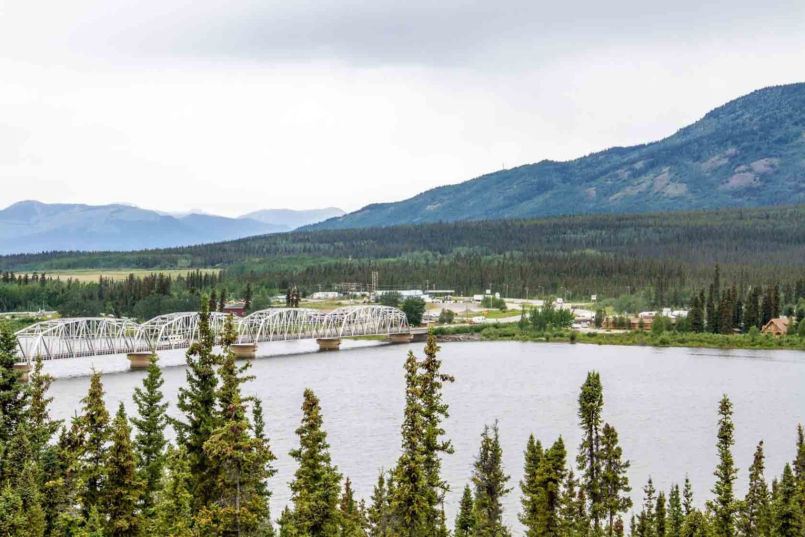
16 June - Drive from Alberta to Dawson Creek

     We departed the Whistler's Campground in Jasper National Park around 8:00 headed for about a 320 mile run up to Dawson Creek in British Columbia which is where the Alaska Highway starts at mile marker "0". This leg was on a two lane secondary road called the Big Horn Highway.

     We had views of mountains for much of the drive but eventually got into some pretty remote heavy forest areas. The logging industry was very big in that part of Alberta and heavy trucks have taken a toll on the roads....not terrible but heavily worn in spots and a lot of road work. Also along this stretch the towns were  few and far between....gas stations too - I remember seeing signs saying the next gas station is 184 Kilometers (about 115 miles) so you need to plan carefully. Glad I installed an auxiliary fuel tank.

     We stopped in one of the small towns called Grand Cache and refueled and found a diner called the Big Horn Restaurant and Pub where we had lunch. "Would you like gravy on your fries" the waitress asked all four of us.....I was the only taker - when in Rome, right? It was not bad but not sure I'd do it again.

     My weather lady and co-pilot had been keeping an eye on the Dawson Creek weather in anticipation of our arrival because we hoped to spend a couple days here shopping for supplies, doing laundry, and weather permitting, playing some golf. She kept seeing rain advisories for the couple of days prior and it did rain a little the day of our arrival but the following days were to be in the 70's and sunny (sign me up for some of that). As we got closer to Dawson Creek on the drive in, there were a couple places where flood water was crossing the road and we could see farms and homes with a lot of rising water. Turns out the town is flooding pretty bad.

Highway 43 headed to Dawson Creek


     As we follow the GPS to our campground we approach a bridge that appears to be washing out so we are detoured to another bridge that was closed by the time we got there. Like good campers do, we headed for the Walmart parking lot to regroup and come up with a plan. We learned from our friends Jim and Sheila (who were ahead of us a bit) that there was an alternative way and they told us how to get there. Ironically, the alternative way took us right by the Dawson Creek County Club and Golf Course which, you guessed it, was mostly under water. Won't be playing golf in Dawson Creek and we immediately turned our planned three night stop into two and began wondering if there would be other issues up thee Alaska Highway.

Hole #3 at Dawson Creek Country Club
(cancel our tee time please!)


     We finally get settled into camp about 6:00 P.M. local time.....we gained another hour on this leg.....now three hours behind the east coast. After setting up we were really glad that I had grilled a pork tenderloin the night before (while Ed grilled the chicken) so dinner tonight was pretty easy to prepare. Four tired pups went to bed soon after dinner.

17 June - Dawson Creek down day

     The weather is perfect for golf if the ground was not so saturated and the course flooded. We are still taking full advantage of our stop to rest, catch up on chores/maintenance, etc.... This is the first day in awhile that I would consider wearing shorts, I'm not but did consider it. It is a very nice 63 degrees and sunny with little wind. Feels great!

     Grocery shopping and laundry were high on the list for us and the Culpeppers and I needed to try  catching up on the blog while I had service and electricity. It was a pretty productive day and we managed to get some much needed rest also.

     We went to the mile marker "0" for a photo session this afternoon and after that we decided to run north on the Alaska Highway for 20 minutes or so without the trailers to see an old wooden bridge called the Kiskatinaw Bridge. It was part of the original highway and is an amazing piece of work....a wooden bridge that is curved and still in use today...we just didn't think driving our RVs across it was a good idea. This part of the Alaska Highway has been rerouted.

     Heading north to Fort Nelson tomorrow.

Mile Marker "0" Photo

Kiskatinaw Bridge - built 1942


Ed & Kay


18 June - Alaska Highway - Dawson Creek to Summit Lake

     As we left the campground in Dawson Creek both Kathy and I commented on how warm it was and we wished we'd put on shorts....really felt hot to us. We looked at the thermometer on the truck and it was 59 degrees....you know you've had some cool weather when you complain about the heat at 59 :-)

     We said good bye to Jim and Sheila as we left the Mile "0" campground headed up the Alaska Highway. They had met many of the folks that were gathering there for their caravan. We promised to meet for lunch some time in Atlanta or Chattanooga to compare notes of our Alaska trips. Our travel plans for this day were to make it to Fort Nelson and spend the night but we had such a good travel day that it was just 3:00 or so when we arrived there and we decided to press on a bit farther.

My first impressions based on the first 350 miles of the Alaska highway were:
  • The road is better than expected (I'd heard some horror stories)
  • Not much wildlife for the longest stretch but just before Fort Nelson we started seeing bears
  • Not many people or homes anywhere
  • A lot of natural gas industry and several work camp type lodging facilities
  • Lots of wilderness and not much traffic
  • It could get lonely out here - glad Ed and Kay are with us
Alaska Highway (from first 350 Miles)

Alaska Highway (from first 350 Miles)

Alaska Highway Construction Zone (from first 350 Miles)


     Just prior to arriving at Fort Nelson (within the last 30 miles) we began seeing some black bears in the area just off the highway and we naturally had to try photographing them. We ended up seeing 7 or 8 of them and after the first several we just rode by and admired them. (No more photos). Kathy did manage to get a good/different looking black bear photo that we were quite entertained by. As she shot the picture she said she thought the bear was peeing....liquid flying as he reared back. On the back of the camera we got tickled trying to figure out if that is what it was and identify the body parts we were seeing. After getting it on the computer we realized that the Bear was in or near some water (creek or ditch that we couldn't see) and when we raised his paw to scratch the wet paw slung water everywhere.....a unique photo none the less.

Kathy's Wet Bear

Look at those teeth

  
      When we rolled into Fort Nelson we had a team meeting to discuss how much farther to go and when to stop. In our trusty Milepost (Alcan Travel Guide) Kathy had read me an article about a campground on the Tetsa River where they also had a bakery and brag about the cinnamon rolls fresh baked.....that sounded like a good target to me so we headed there. Upon arrival, the smell of cinnamon buns was nice but they had none left and wouldn't have anymore 'til morning. Although we were temped to stay, they only had 15 amp service and we decided to push on a bit farther.

     Another 20-30 miles we came upon a Provincial Park (much like our state parks) that was called Summit/Stone Mountain Park....turns out it is the highest location on the Alaska Highway at 4200 feet and the campground was in between some mountain peaks and right on a lake and stream.....no hook ups - no phone, no internet, no problem ;-) but a nice setting and the price was right. We set up camp, grilled some pork chops and were able to sit outside (72 degrees today) and enjoy the weather.

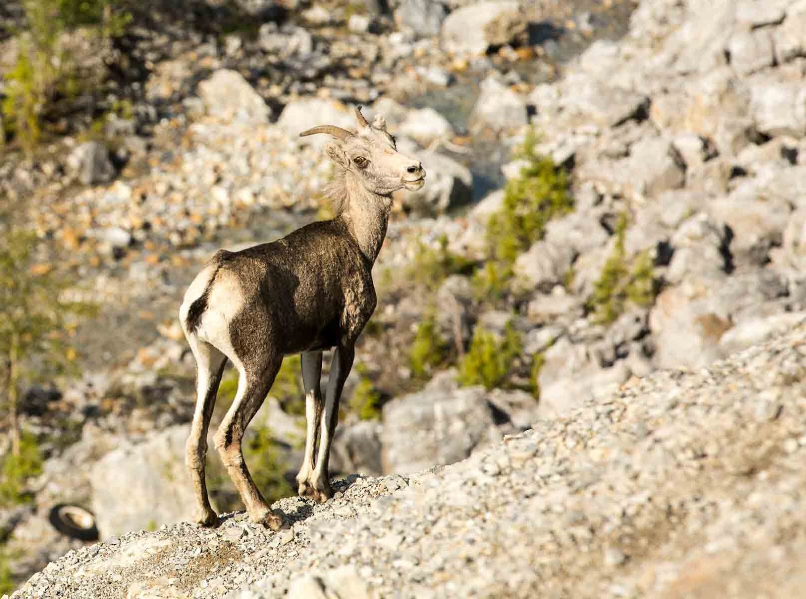
     This area is known for Stone Sheep and a park employee told us they were out a couple miles down the road while we were cooking. After dinner we rode down to see if we could find them but no luck.

Summit Lake Campsite

Lake Summit Wild Flower


19 June - Summit Lake to Watson Lake

     We all agreed that Summit Lake was a great stop....most of us slept well (not Ed) and it was just a beautiful setting. Before we got on the road to our next scheduled stop (Watson Lake) we took another ride (without campers) to look for the stone sheep and sure enough, eagle eye Ed spotted a group of them and we enjoyed watching and  photographing them before returning to hook up the campers.

Young Stone Sheep


     We had travel plans to make it to Watson Lake, only about 240 miles away but a couple scheduled stops on the way.....not counting the unscheduled animal stops.....there were many. Ed and Kay had the lead and not long on the road they spotted a female moose (first one on this trip) but by the time Kathy and I got there she was heading into the woods so no photos. They ended up seeing another moose later in the day, again when they were well ahead of us and we missed that one as well.

Alaska Highway Construction zone

Alaska Highway


     First stop was Muncho Lake - a really large and pretty mountain lake. Ed and Kay camped here on their trip ten years ago. It was a good break from the drive to get out and walk around a bit. And as we were leaving that area we saw some more stone sheep really close to the highway and they did not seem as skittish as the ones at Summit Lake in the morning.
Baby Stone Sheep

Muncho Lake

     By the end of the day we had also seen several more bears  including a cinnamon brown black bear....I think that is right but honestly they are all grizzlies to me. We did manage a few good photos....can't stop photographing the bears.

Cinnamon black Bear (I think)


     We pulled into a Provincial Park called Liard Hot Springs as lunch time approached. This too was a scheduled stop as we wanted to experience the springs. After fixing some lunch in the campers and changing over to our bathing suits we headed down the boardwalk for the springs. They are a natural spring that maintains between 107 and 127 degrees. It felt great and was very warm. Only mishap there was Ed jumping in without first taking his hearing aide out....not sure yet if it will live.

Liard Hot Springs


     Leaving Liard Hot Springs with the water truck leading....oh yes, we have walkie talkies and my handle is "Water Truck" and Ed is "Dodge-Pepper." I tried to give him a handle with diesel in it....Diesel Dan, etc... but he was sick of diesels at this point and wouldn't have it.

     As we rolled on across the Yukon border just prior to getting into Watson lake we stopped at a place fuel stop/store that Paul and Eugenia (people we met in Columbia Falls from Mitchell County) recommended called Contact Creek....said the couple running it were originally from Florida and had moved here in 1979. I asked the guy about the winters and he said he nearly froze to death the first winter it got to -70 degrees but he is used to it now.

     We pulled into Watson Lake and are at a full service campground  but the power has gone out at least four or five times already. Someone said this town produces all power via generators and the heat (83 degrees today) has put an overload on them. We walked across the street to a local diner to eat and then went to a Northern Lights Planetarium show. Ed made up for the sleep he lost last night in that show.

     Heading out for Whitehorse, Yukon Territory tomorrow.  


Friday, June 17, 2016

Ice Field Parkway and Jasper

Weather

     Let me say that we have had it all to this point  (except warm and sunny) -  wind (and a lot of it), sleet, rain and snow, yes snow! The temps have been mostly in the 40's with an occasional heat wave approaching 50 :-) We have learned to appreciate 50 degrees lately.

June 14th - Ice Field Parkway and the Columbia Ice Field

    All I can say is WOW - this is jaw dropping scenery and an experience we will never forget.
We left the Banff area early with plans (weather permitting) to stop by the Columbia Ice Field and tour there so we would not have to back track from Jasper. As we started onto the Ice Field Parkway, early on, we saw a black bear on the roadside and Kathy took photos but he would not cooperate and give her a full face shot....still exciting but no good photo of that one.

Leaving Banff headed to Jasper (Auburn fan lead dog)

Highway view leaving Banff

    
     The scenery was awesome on this drive even though the weather was pretty cool and a bit cloudy/foggy which made for some pretty interesting views of mountain peaks shooting above the fog. We did see some mountain goats at one stop but from a distance and they appeared to be shedding a lot of their hair on their neck.....not sure if this was normal or if something else was going on with them.

Mountain Goats - Long shot

     We stopped about midway of the parkway for fuel at the only stop available. I was okay on diesel but needed some gas for the generators. As it turns out,  it was good thing I didn't need much fuel because the cost of gas there was $6.22 (US) per gallon. (Ouch) Ed, on the other hand, had to fill up and got to enjoy the full effect of that cost :-(

     When we arrived at the Columbia Ice Field we ran into some folks from Chattanooga Tennessee, Jim and Sheila Lemons, who we had met in Glacier National Park and were also going to Alaska. They are meeting their caravan in Dawson Creek. So, we saw them again in Banff, now at the Ice Field and they are staying in the same campground as us in Dawson Creek. By now we are good friends and exchanging contact info.

Jim Lemons (left) taken by his wife Sheila


     At the Ice Field we purchased tickets that were good for a trip out on the Athabasca Glacier on an Ice Explorer, a walk on the Glacier Skywalk and a boat ride on the Maligne Lake up near Jasper (next day). We spent about three hours total at the ice field and what a great experience. We learned a lot about the glaciers receding, etc... and it was cool (no pun intended) just being on them and learning how they are formed.

Not a lunar landing but felt like it!

Panoramic view from the visitor's center


     The ice explorer vehicles cost over 1.4 million and the guide said that each tire is $5K and they have six. (Might help explain the ticket cost....but worth every penny). We were surprised to learn the tires only hold 14 psi of pressure. There are only 23 of these vehicles made and 22 are here, one is being used by the US government for research in Antarctica. In our trek up to the glacier we traversed a 32% grade which felt really steep but the vehicle is built to handle that.

Ice Explorer

    
     The Glacier walk is a glass floored arch that extends 100 yards out from a cliff and is 900 feet from the canyon below. I have to admit it was a little uneasy feeling for me being out there. The other three (Kathy, Ed, & Kay) were either not bothered or wouldn't admit it. If you look closely at the photos you may see my hand prints and scratch marks on the hand rail :-)
And it was wet and rainy out there!


     After leaving the Ice Field we continued on to our next campground in Jasper. Soon after departing we saw a big horn sheep on the road side. It was on the drivers side and I did manage a photo shot but the guardrail ruined the full photo....having to settle for a heavily cropped eye and horn.

Here's looking at you!


     Our accommodations at Jasper National Park for the next two nights were without any hook ups....no water, electricity or sewage so we were roughing it (somewhat) for a couple nights. Kathy's shower's were much shorter than she preferred in order to avoid running out of water. The generators again proved to be a much needed asset but we were limited on when we could run them in order to observe quiet hours in the campground. Also limited internet (blog/photo work) activity.

June 15th - Maligne Lake Cruise
    
     Heading out for the cruise first thing in the morning which is an hour's drive from the campground we drive through the Maligne (pronounced ma-leen) Valley which is also known for wildlife and sure enough we spot a black bear near the roadside and are able to get some photographs of him.

Maligne Valley Black Bear

    
     The Lake cruises started at 10:00 and the last one is around 6:00 P.M. so our thought process was go early so hopefully it won't be as crowded AND maybe we can enjoy the lake cruise before the wind gets up and the water gets choppy - wrong! Not only was the wind up and the water choppy, it snowed. Not flurries but SNOW and it snowed the whole time! Ed said this is the first boat ride he had ever taken in the snow (me too).....thank goodness the boats were enclosed. So, the visibility was not great and the photo conditions were less than ideal but it was still good...partially because of the great onboard narrator (Cam) who is a young man working here from New Zealand - quite entertaining. There are many young folks from Australia, New Zealand and all over Canada that come here to work these jobs and they are fun/interesting kids.

Maligne Lake Cruise (in the snow)

     The cruise made a stop about 35 minutes in at a place they called Spirit Island.....actually a peninsula most of the time but occasionally the water rises enough to make it an island, and like Cam said, Spirit Island sounds much better than Spirit Peninsula. We spent about 20 minutes there walking a short trail and taking photos.

Boat (not ours) heading around Spirit Island


     The brilliant blue/green color in these mountain lakes is because they are glacier fed and the glacier activity produces what they call "rock flour"...tiny sediment that reflects in the water producing the color. Maligne lake was really pretty but the weather prevented being able to see it as clearly in the photos.

     In the afternoon we found a spot for a picnic lunch by the river and did some exploring (riding) the area around Maligne Lake and also did a drive thru the town of Jasper and up above the town to Pyramid Lake. We did spot an Elk but they are becoming so commonplace that we rarely stop to photograph them anymore....leaving that for the "new" tourist, aye :-)

     Ed grilled up some chicken for dinner that Kay added to a stir fry and we made plans over dinner for the coming days while enjoying a perfect meal and a couple of adult beverages. Heading out of Jasper tomorrow for Dawson Creek in British Columbia.

Additional photos from the last couple days below:

Sun City folks turned ice explorers

Sporting my new cap

Athasbasca Glacier


Pyramid Island

Me trying to stay warm :-)

Maligne Boat House

Photographing Aspen trees and an Elk photo bombed

A cool dude!